
River Water Level Monitoring System
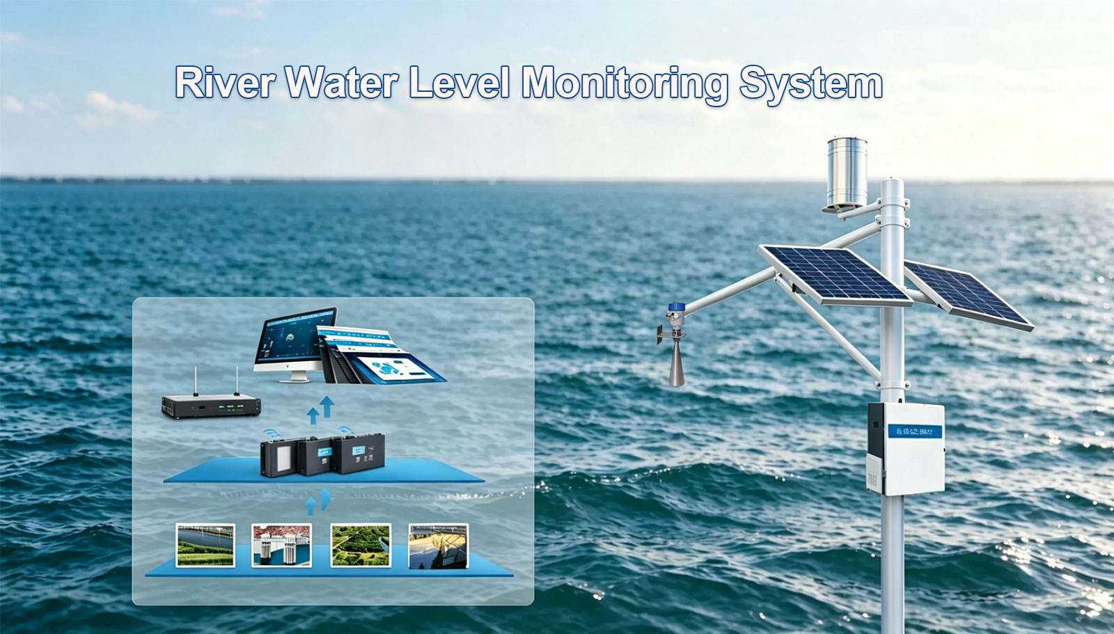
Continuous, unattended stage measurement for rivers, streams and gauging stations — radar level sensing with 1 mm resolution, solar power and telemetry to one cloud platform.
Why This System
Most monitoring programmes fail not for lack of instruments, but because the record is broken. Three gaps this system closes.
1.Manual gauge readings are expensive, inconsistent and they do not scale across a river network.
taff-gauge visits sample a moment in the day. Regulation, flood reporting and allocation need a continuous record that survives for years without an operator on site.
2.Flood peaks rise and fall between two site visits — the record you need most is the one nobody captured.
Peak level, peak timing and recession rate are all missed by intermittent readings. Continuous logging is the only way the event itself becomes evidence you can act on.
3.Remote cross-sections have no mains power and no staff, so continuous logging looks impossible.
A radar level sensor with a solar-powered RTU runs unattended at sites that are impractical to visit weekly — which is exactly where the gaps in your record are today.
Parameters Measured
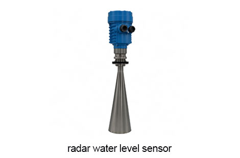
Core sensing is provided by the GX-701LD radar water level sensor. The values below are the published technical parameters for that sensor.
| Parameter | Instrument | Range | Accuracy |
| Water level (stage) | GX-701LD radar water level sensor (non-contact) | 0–30 m / 0–70 m (model) | ±1–3 mm |
| Resolution | Same unit, no configuration change | 1 mm | — |
| Rate of change | Calculated in the RTU from consecutive stage readings | Configurable | — |
| Water temperature | Optional, integrated with a submersible pressure sensor | — | — |
| Sensor specification | Value |
| Range | 0~30 m / 0~70 m |
| Accuracy | ±1~3 mm |
| Resolution | 1 mm |
| Data Output | 4-20 mA / RS485 |
| Power Supply | 12 VDC( 10 V~28 V DC) |
| Temperature Range | -20 ℃~+70 ℃ |
| Humidity Range | 0~90% |
| Ingress Protection | IP67 |
System Architecture
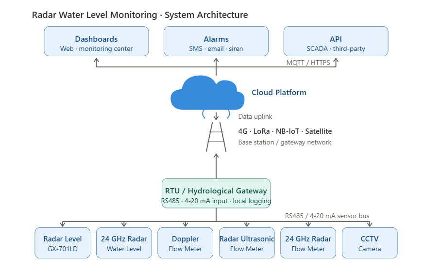
The sensor outputs over RS485 or 4-20 mA. The RTU reads the value, time-stamps it and drives the uplink — readings are buffered at site and back-filled when the link returns, and threshold logic runs locally even if the network is down.
GX-701LD Radar Level Sensor
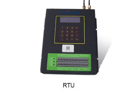
RTU (RS485 / 4-20 mA input)
4G · LoRa · NB-IoT · Satellite
Cloud Platform
Dashboards · Alarms · API
Recommended Configuration
A standard bill of materials for one site. Quantities scale with the number of cross-sections; we return a costed BOQ within two working days of receiving site conditions.
GX-701LD radar water level sensor
Non-contact microwave ranging; 0–30 m or 0–70 m range options; ±1–3 mm accuracy; 1 mm resolution; IP67; 12 VDC supply (10–28 V DC); -20 °C to +70 °C.
Submersible pressure level sensor(Alternative)
For sites where clearance above the water is too low to mount a radar unit.
RTU telemetry unit
Reads the sensor over RS485 (documented Modbus register map) or 4-20 mA, time-stamps and buffers readings, and drives the uplink.
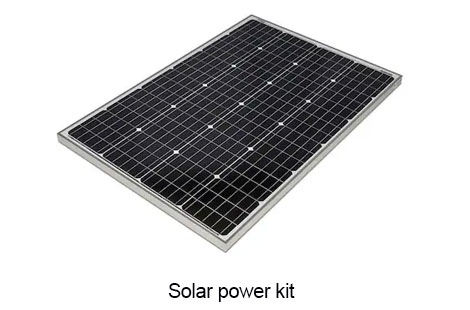
Solar power kit (12 V)
Panel and battery sized to the site solar resource; autonomy target consecutive cloudy days.
Shielded signal cable
National-standard 0.5 mm² conductor is the recommended cross-section for the sensor run.
Mounting bracket / mast
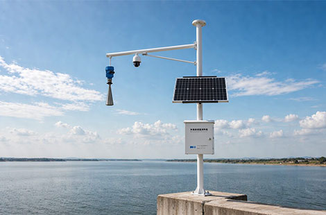
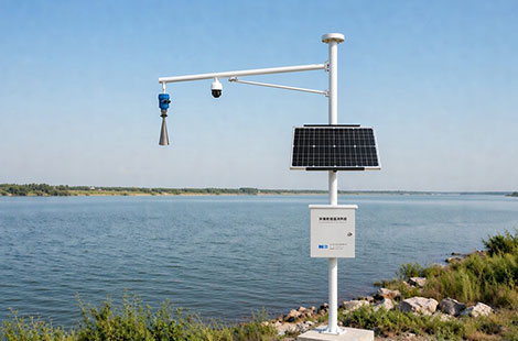
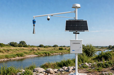
Bridge pier side plate, bank-mounted pole or slope arm. No stilling well required — flow does not affect the measurement, so civil work is minimal.
Cloud platform subscription
Dashboards, multi-level alarms, reporting, exports and open interfaces for your own systems.
Installation & Site Conditions
Mounting position
Bridge pier side plate, bank-mounted pole or slope arm above the water surface. The sensor measures down at the water — no stilling well is required and flow has no effect on the reading.
Commissioning
IVerify the supply voltage before first power-up; confirm the measurement path is clear of obstructions; tighten the cover fully after commissioning — a loose cover is the most common cause of field failures.
Maintenance
No moving parts and no mechanical wear, so the sensing head is maintenance-free. Routine site visit interval 3 months, set per site exposure.
Power
12 VDC supply, operating range 10 V~28 V DC. Solar + battery at remote sites.
Cabling
Shielded cable, 0.5 mm² national-standard conductor recommended; route on the structure, not through the water.
Enclosure rating
IP67 — suitable for outdoor riverbank exposure.
Operating environment
-20 °C to +70 °C; 0–90% RH non-condensing.
Data Delivery & Platform
Live stage curves — stage plotted against time with configurable periods and export
Multi-level threshold alarms — delivered by SMS, email and app push, with escalation lists
Rate-of-change detection — derived in the RTU from consecutive readings — useful for flood onset
Scheduled and ad-hoc reports — exportable for regulators and internal review
Open interfaces — Modbus register map documented on the sensor side; API, MQTT and Modbus on the platform side
FAQ
Radar or pressure sensor — which one suits my site?
The GX-701LD is a non-contact radar unit mounted above the water. It suits most open channels because it never touches the water, needs no stilling well and is unaffected by flow or sediment. A submersible pressure sensor is the fallback where clearance above the surface is too low. Send a photo of the cross-section and we will recommend one.
Which range option do I need — 0–30 m or 0–70 m?
The station reports no data — what do I check first??
Why does my reading jump or fluctuate?
How long can the station run without mains power?