1. Site Overview
Location: Huashan Township, Hongxing Village Group 2 (Coordinates: 102°35′25″E, 27°25′20″N)
Monitoring Personnel: Liu Hong (Contact: +86 130 8925 4172)
At-Risk Population: 16 households (90 residents)
Monitoring System:
2. Incident Timeline
June 9-10, 2020 Extreme Rainfall Event
| Time | Event Description |
| 22:05 | Light rain began |
| 22:40 | Rainfall intensified to heavy storm |
| 22:50 | Rainfall station triggered yellow alert; broadcast system activated |
| 23:20 | Red alert activated; monitoring officer initiated door-to-door notifications |
| 23:37 | Extensometer #2 detected deformation |
| 23:55 | Extensometer yellow alert triggered |
| 00:10 (June 10) | Red alert activated; evacuation warning broadcasted |
| 00:50 | Rainfall ceased (Total accumulation: 140.2mm) |
Key Outcomes:
80-minute advance warning achieved
100% at-risk population received alerts
Zero casualties or property damage
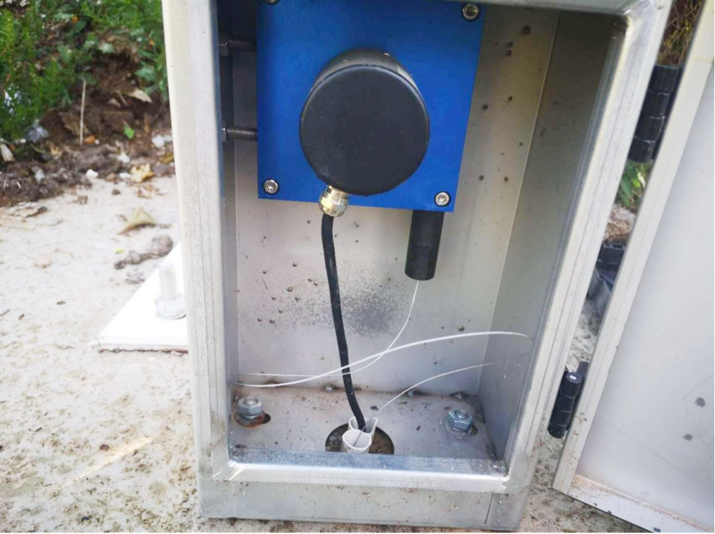
3. System Performance
Post-event Equipment Status:
![landslide morning]()
![landslide monitoring]()
Rainfall station: Fully operational
Extensometer #1: Normal operation
Extensometer #2: Sensor damaged by landslide (replaced)
Broadcast system: Continuous alert transmission confirmed
4. Landslide Characteristics
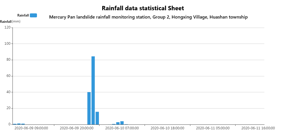
![landslide rainfall monitor]()
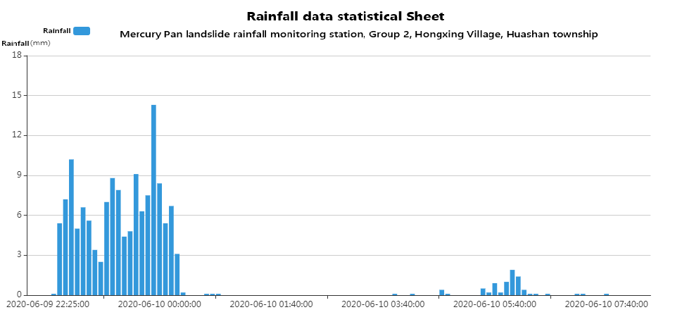
![landslide rainfall monitor1]()
From the above hourly rainfall bar chart and minute rainfall bar chart, it can be clearly seen that this rainfall began at 22:05 on June 9, 2020, and lasted until the early morning of June 10, 2020. The entire process saw continuous rainfall of over 140mm, with the rainfall reaching 140.2mm from 22:30 on June 9, 2020 to 00:50 on June 10, 2020.
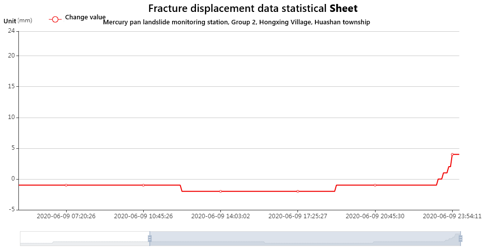
![landslide rainfall monitor2]()
As can be seen from the above figure, the crack underwent a sharp change before the landslide occurred. It roughly started at 23:37 on June 9, 2020, and lasted until the moment of the landslide (around 00:10 on June 10). The deformation duration was about 30 minutes, and the deformation rate was as high as 288mm/d. Moreover, the time of its occurrence has a strong correlation with the period before and after the formation of this rainfall.
5. Verification & Analysis
Field Observations:
Monitoring Data Correlation:
6. Conclusion
This event demonstrated:
System Effectiveness: Integrated monitoring successfully predicted slope failure 80 minutes in advance
Alert Reliability: Local mesh network ensured real-time warning dissemination
Human Factor: Monitoring officer's proactive response complemented automated systems
Data Quality: Clear precursor signals enabled accurate risk assessment
The Shuiyinpan landslide early warning represents a model case of successful geohazard mitigation through integrated technical systems and community preparedness.