Drone weather sensors. These sophisticated, compact instruments transform UAVs into flying weather stations that can capture precise atmospheric data. These technologies open up new frontiers for environmental monitoring, from protecting critical infrastructures to advancing climate science.![Drone weather sensor for energy station -BGT]()
This article examines how Drone 3D Anemometer and integrated Weather Station are solving real challenges in multiple industries. They provide insights that were previously either impossible or prohibitively costly to obtain.
The technology behind drone-based atmospheric monitoring
The latest Drone Weather sensor systems are a combination of miniaturization and meteorological science. The typical advanced setup includes the following:
UAV Anemometer : These ultrasonic sensors are designed specifically for aerial platforms and measure wind speed and directions in three dimensions, without moving parts. This ensures reliability and accuracy, even in challenging flight situations.
Multiparameter weather station Compact units that incorporate temperature, humidity and pressure sensors, as well as sometimes gas concentration sensors
Visibility sensors and precipitation sensors : optical systems that detect precipitation and measure atmospheric transparency
Advanced Data Processing: Onboard computing which correlates sensor readings and GPS data with inertial measuring unit data
These components combine to form a complete Drone weather sensor package, which transforms any UAV compatible into a mobile atmosphere observatory.
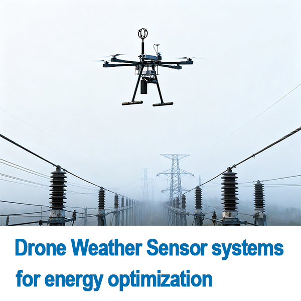
Revolutionizing Infrastructure Management
1. Smart Grid Protection and Optimization
To protect their transmission infrastructure against weather-related damages, power grid operators are increasingly using Drone 3D Anemometer. The traditional ground-based weather station cannot capture complex wind patterns which affect overhead powerlines.
Highlights of
Conductor Galloping Prevention: Anemometer Systems flown along transmission lines detect wind conditions which cause dangerous oscillations
Ice accumulationYu Ji: The integrated weather station detects temperature and humidity to cause ice formation.
Assessment of wildfire risk: Early detection and prevention are possible due to dry conditions, high winds, and other factors.
Case Study:
After implementing a Drone weather sensor program along critical transmission lines, a major utility in California has reduced weather-related power outages by 52 percent.
2. Wind Energy Optimization
Drone 3D Anemometer is a new technology that has been adopted by the wind energy industry to overcome the limitations of traditional weather towers. These systems can provide detailed atmospheric measurements over entire wind farm sites.
Transformative Applications:
Analysis of turbine wakes: UAV Anemometer arrays that map the effects of turbine wakes on downstream units to enable layout optimization
Turbine specific calibration: Each wind turbine is calibrated based on the local wind conditions as measured by Drone weather sensors.
Ice detection : Rotor blade icing is detected before it impacts performance.
Impact Measurement:
A European wind farm has reported an increase of 7.3% in energy production following the implementation of Drone 3D Anemometer based optimization strategies.
3. Structural Health Monitoring
Traditional measurement methods cannot provide the precise wind loads required for tall structures such as bridges, skyscrapers and other tall buildings. Drone Weather sensor systems provide structural engineers with revolutionary capabilities.
Critical Applications:
Bridge wind loads assessment: Anemometer UAV systems measures complex wind patterns around the bridge decks while construction and operation.
Building Aerodynamics: Skyscraper designers use Drone 3-D Anemometer to optimize structural design and damping system
Construction Safety: Protecting workers and equipment with real-time wind monitoring
Advancing Environmental Science and Research
1. Climate Change Research
Environmental scientists use Drone Weather Sensor to collect atmospheric data in areas where traditional monitoring methods are difficult or impossible.
Research Applications:
Urban Heat Island mapping: weather station equipped Drones map microclimates throughout cities
UAV Anemometer Systems measure energy exchanges between ice and atmosphere interfaces
Carbon emissions tracking Drones equipped with gas sensors create vertical profiles of concentration downwind from industrial facilities
2. Agricultural Optimization
Researchers and farmers are using Drone weather sensor data for better crop management.
Implementation examples:
Frost protection Weather station Drones can identify temperatures inversion conditions and enable targeted interventions.
Microclimate maps: Drone 3D anemometer systems produce detailed maps of wind patterns on fields
Spray Optimization: Real time wind data allows precise application of agricultural chemicals
Enhancing Transportation Safety
1. Port and Waterway Management
Traditional forecasting is not able to provide the precise local weather data that maritime operations need. Drone Weather sensor offers revolutionary capabilities to port operators.
Safety Applications:
Fog detection: weather station equipped with drones detect fog banks forming before they become dangerous
Alerts for wind shear: Anemometer Systems identify dangerous wind variations in port areas
Safety of crane operation: Wind monitoring at container terminals.
2. Urban Air Mobility Infrastructure
Drone weather sensor systems provide the precise weather data at low altitudes that is needed by the emerging urban air transport industry.
Important requirements:
Drone 3D anemometer Systems map complex wind patterns between building
Vertiport Microweather: Site specific monitoring for takeoffs and landing zones
Weather corridors: Continuous Monitoring Along Proposed Flight Paths
Implementation Considerations
In order to successfully deploy Drone Weather Sensor, it is important that you consider several practical aspects.
1. Regulatory Compliance
Meteorological operations require airspace authorization
Sensor certification and data validity protocols
Privacy considerations during monitoring operations
2. Technical Integration
Data Fusion from Multiple Drone weather sensor Units
Data transmission and processing systems in real-time
Integration with existing Infrastructure Management Platforms
3. Operational Protocols
Automated flight plans for optimal data collection
Maintenance schedules for sensor calibrating
Extreme weather conditions: emergency response procedures
The Future of Drone-Based Atmospheric Monitoring
The next-generation Drone Weather Sensor will feature:
AI enhanced data analysis Machine learning algorithms that turn raw atmospheric data into predictions
Swarm network: Multiple drones collaborating to create 3D atmospheric models
Advanced Sensor Fusion: Integration and monitoring of environmental data using other sensors types.
Drones with autonomous operation. Drones can self-deploy based on the weather and monitoring requirements.
So we can see: The New Atmosphere of Possibility
Drone weather sensor represents a fundamental change in the way we monitor and analyze our atmosphere. These systems solve critical challenges for infrastructure resilience, public safety, and environmental protection by bringing sophisticated weather instrumentation to the third dimension.
The applications of the technology will continue to expand as it continues to develop through miniaturization, AI integration and enhanced autonomy. In our climate-conscious society, it is certain that understanding the atmosphere in three dimensions becomes increasingly important.
The message for infrastructure managers, environmental researchers, and safety experts is clear: future atmospheric monitoring will not be grounded. It will be airborne, smart, and ready transform the way we interact with air.