Naviboat 8: The Smart Unmanned Surface Vessel for Pollution Monitoring and Water Surveys
Water is at the heart of every community, yet managing it is becoming harder. Pollution events, flooding risks, and the demand for accurate data challenge both governments and industries. Traditional boats and manual sampling are costly, time-consuming, and often unsafe.
This is why Unmanned Surface Vessels (USVs), also called marine drones, are changing the way we work on water. The Naviboat 8 is designed as a practical, high-performance pollution monitoring USV that solves real problems for hydrologists, surveyors, and environmental managers. It is not just a vessel—it is a smarter way to collect data, manage resources, and protect communities.
Why Organizations Turn to Unmanned Surface Vessels
Switching from manned boats to Unmanned Surface Vehicles means:
Less cost – reduce manpower and fuel needs.
More safety – avoid sending people into dangerous waters.
Faster results – automate surveys and monitor pollution in real time.
Better data – achieve centimeter-level accuracy with advanced navigation.
For any organization facing water challenges, a marine drone like Naviboat 8 is a long-term investment that delivers efficiency, safety, and reliability.
Multiple return-to-home modes and shallow water protection.
Flexible Sensor Integration
30cm moon pool supports ADCPs, echo sounders, sub-bottom profilers, and water quality sensors.
Collects data on pollutants, nutrients, and flow conditions.
Compatible with mainstream hydrological instruments.
Easy Operation & Data Access
Android app with multi-route planning and real-time display.
Remote control up to 2.5km, unlimited via 4G.
Multiple data ports (RJ45, RS232, RS485) for smooth integration.
Solving Real-World Challenges
Pollution Monitoring
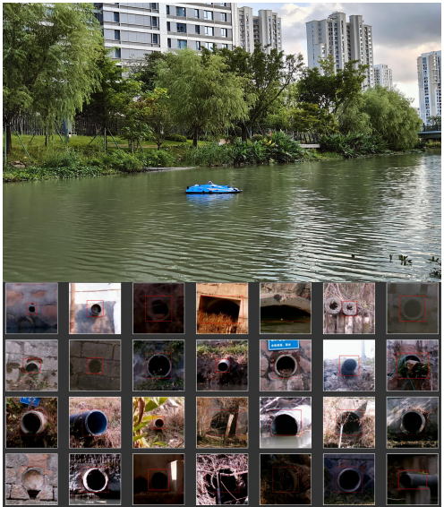
When rivers or lakes are at risk, the Naviboat 8 pollution monitoring USV helps agencies collect water quality data quickly and safely. Parameters such as Total Nitrogen, Total Phosphorus, Dissolved Oxygen, and turbidity can be tracked in real time. This makes it possible to respond before small issues turn into environmental disasters.
Hydrographic & Bathymetric Surveys
Reservoirs, ports, and waterways need accurate underwater terrain data. With multi-beam sonar and sub-bottom profilers, Naviboat 8 gives surveyors precise maps without the risks of manned boats.
Hydrological Flow Measurement
Flood management and water resource planning require flow data. Equipped with ADCP, Naviboat 8 delivers accurate discharge and velocity profiles across river cross-sections.
Environmental & Scientific Research
Researchers can integrate nutrient analyzers, samplers, and spectral cameras to monitor ecosystems. The marine drone supports long-term studies with reliable data collection in all conditions.
Emergency Response
During floods or pollution incidents, Naviboat 8 can be deployed immediately. With video transmission and real-time monitoring, decision-makers get the information they need when every minute counts.
Value for Users
Naviboat 8 is built to deliver:
Efficiency – faster data collection reduces project timelines.
Cost savings – less manpower and fewer resources required.
Safety – no need to send crews into dangerous waters.
Accuracy – data you can trust, with centimeter-level precision.
Flexibility – from pollution monitoring to hydrographic mapping, one platform covers it all.
It is more than a vessel—it is a reliable partner for governments, environmental agencies, and research institutions.
You use data logging and telemetry to keep water safe. These tools help protect your community. Collecting good data lets you find problems early. It also helps you manage resources better. Researchers say it is important to spot strange data quickly. This makes the information more accurate. Experts suggest some steps for future plans:
Look at how much money you spend and save.
See how fast you get your money back.
Think about how the system can grow.
Smart technology like the Naviboat 8 Unmanned Surface Vessel gives you real-time updates. It helps you make better choices, ensures cleaner water, and creates a safer future.
Related Products
content is empty!
Related Blogs
content is empty!
Meanwhile, we have software and hardware R&Ddepartmentand a team of experts to support customers' project planning and customized services