Flash Flood Disaster Monitoring And Early Warning Solutions
Torrential rain, particularly sudden short-duration heavy rainfall, is one of nature’s most devastating displays of power. In a matter of minutes, it unleashes immense energy that overwhelms both natural landscapes and urban systems, triggering a cascade of deadly secondary disasters:
Flash Floods: Torrents of water surge through mountain valleys, swallowing roads, homes, and infrastructure with terrifying speed. The sheer force, combined with debris like boulders and sediment, leaves utter destruction in its wake.
Mudslides: Rain-saturated soil and loose rock mix into a viscous, fast-moving slurry that obliterates everything in its path, burying entire areas under meters of mud and debris.
Landslides/Rockfalls: Water infiltration destabilizes slopes, causing partial or catastrophic collapses that threaten lives and structures downhill.
Urban Waterlogging: Drainage systems fail under extreme rainfall, turning streets into rivers, flooding basements and subways, paralyzing transport, and leading to electrocution, drowning, and critical infrastructure damage.
BGT Hydromet’s Flash Flood Disaster Monitoring and Early Warning Solution delivers a complete ecosystem that combines field products, intelligent platforms, and management systems into one unified framework.
The flash flood warning system consists of a simple water station, a simple rainfall station, a wireless early warning broadcast and a household alarm (APP message can also be selected) through wireless connection.
System stability and security: The early warning system uses a variety of communication methods, can still work normally under the condition of network interruption and power failure, to ensure that the flood disaster monitoring is not interrupted, and to protect the safety of people's lives and property;
Automatic data collection: collect rainfall information in real time, and send the real-time rain situation to the mountain flood business platform, so that the flood control staff can obtain information in time, and provide support for the mountain flood early warning decision;
Diversification of early warning means: manual early warning, platform early warning, short message early warning, broadcast early warning, a full range of early warning means to convey early warning information to everyone;
Multi-communication links: Monitoring and warning equipment support 3G/4G/5G full Netcom /NB-IOT/ Beidou and other public network communication and local LoRa-Mesh AD hoc communication, to achieve mutual backup monitoring and warning transmission network;
Accurate early warning and early warning into households: collect rainwater information in real time, and send rainwater information to residents' homes, so as to realize the early warning information directly into households and people, and increase the transfer time of the masses;
Low power application scenarios: The system monitoring equipment adopts low power design, and can use solar energy combined with battery power supply, which is not limited by remote mountainous areas and other environments.
System Architecture
Hardware Components
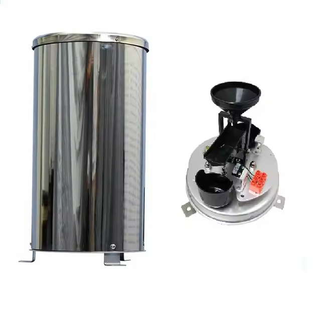
Simplified Hydrological Stations
Water Level Monitoring Station: Equipped with submersible pressure sensors for real-time river/reservoir level detection.
Rain Gauge Station: Tipping-bucket precipitation sensors with ±2% measurement accuracy.
Maintenance-Free Rain Gauge: Solar-powered wireless transmitter with self-cleaning mechanism.
Warning Terminals
Wireless Broadcast System: IP65-rated outdoor horn units with 5km coverage radius.
In-house Alarm Unit: LED visual & 95dB audible alerts for household notification.
Integrated Warning Station: Solar-powered all-in-one unit combining data reception and broadcasting.
Communication Network
Dual-Mode Connectivity:
Public Networks: 3G/4G/5G/NB-IoT/BeiDou satellite backup
Local Networks: LoRa-Mesh self-organizing network (1-10km range)
Software Platform
Central Management System
Real-time dashboard for hydrological data visualization
Cross-platform interoperability with provincial/national disaster management systems
The Digital Vanguard: Mountain Torrent Early Warning System
Modern Mountain Torrent Early Warning Systems represent a paradigm shift in disaster prevention. This sophisticated network integrates monitoring, analysis, prediction, simulation, decision-making, and dissemination into a cohesive defense mechanism against nature's fury.
System Capabilities:
Advanced Risk Prediction
Synthesizes meteorological forecasts with real-time monitoring data (rain gauges, radar, soil moisture, terrain models, and hydrological data)
Employs precision algorithms to identify high-risk zones (potential flash flood, landslide, debris flow areas) with lead times ranging from hours to critical minutes