System Introduction
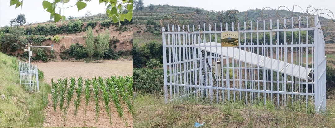
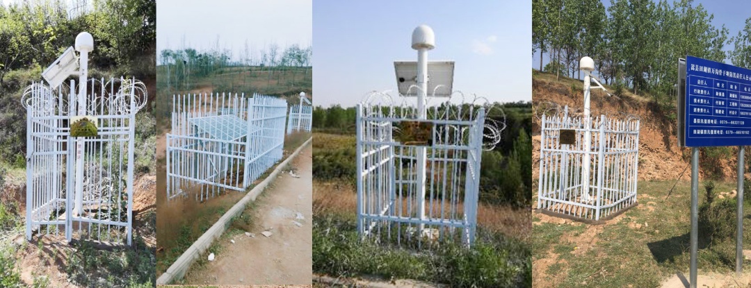
The Automatic Monitoring System for Warping Dams leverages modern monitoring technologies to independently deploy rain gauges, water level sensors, piezometers, stress gauges, surface displacement stations, and video surveillance stations on each dam, all powered by solar energy. Data is transmitted wirelessly via 4G/5G/LoRa/GPS/BeiDou networks to a centralized monitoring platform for real-time processing, statistical analysis, and early warning generation. This enhances the timeliness, reliability, and accuracy of dam safety monitoring, enabling 24/7 uninterrupted surveillance and timely prediction of potential risks.
During flood seasons, the system provides accurate hydrological data and live images, allowing dam management authorities and responsible personnel to quickly assess flood conditions, implement emergency response plans, and safeguard lives and property downstream.

System Features
24/7 Remote Automated Monitoring
Unified "One Dam, One QR Code" Management
AI-Powered Smart Monitoring
Smart Monitoring & Early Warning
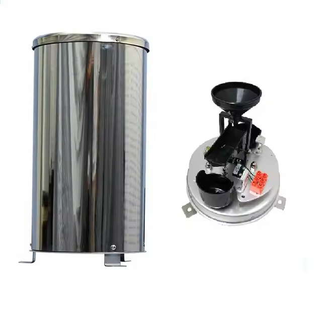
Automatically collects and transmits data on seepage pressure, strain, water level, and rainfall.
Triggers alarms when parameters exceed preset thresholds.
Reliable & Secure Communication
Low Power Consumption & Wide Applicability
![Warning System for Warping Dams-BGT]()
Monitoring Components
1. Sediment & Hydrological Monitoring
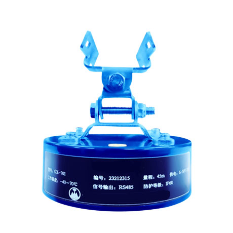
2. Seepage Pressure Monitoring
3. Deformation & Displacement Monitoring
4. Video Surveillance
Warping Dam Safety Management Platform
The proprietary software platform developed by Guoxin Huayuan offers:
Web-based visualization of 19+ monitoring parameters (e.g., surface displacement, rainfall, internal strain, water level, earth pressure, crack detection).
Customizable dashboards with real-time trend curves for data analysis.
Scalable architecture with 100+ reserved parameter interfaces for future expansion.
![Warning System for Warping Dams3]()
Flood Monitoring & Warning System
24/7 tracking of water levels, rainfall, and other hydrological data.
Wireless transmission to backend platforms for flood warning display, data processing, and real-time analysis.
Automated alerts sent to emergency responders and county/city warning centers, ensuring timely disaster prevention and public safety.
![Warning System for Warping Dams_1]()
![Warning System for Warping Dams_2]()