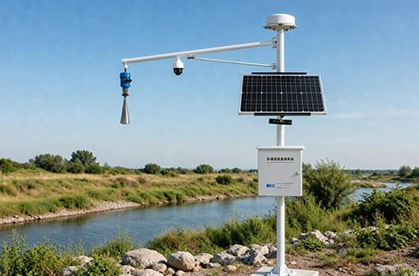
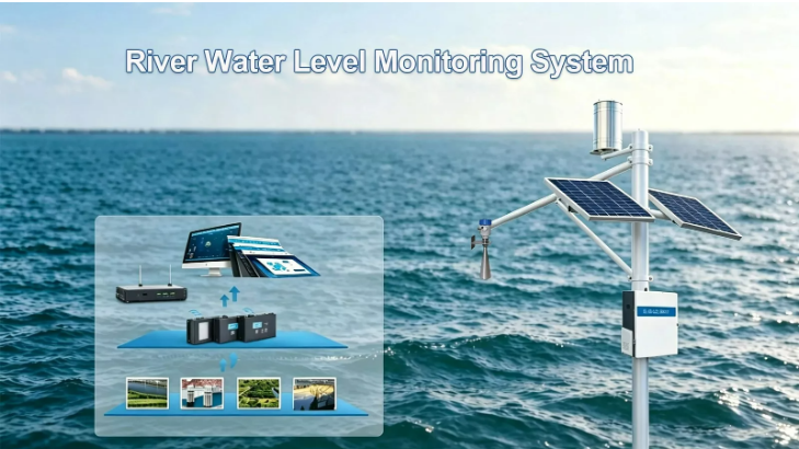
River flow monitoring plays an important role in flood management, water resource planning, and environmental protection. By measuring water velocity, river discharge, and water levels, monitoring systems provide essential information about changing river conditions.
However, accurate flow measurement can be challenging due to sediment, turbulence, seasonal variations, and difficult field conditions. Selecting suitable measurement methods and water velocity sensors is essential for obtaining reliable data.
This article explores the fundamentals of river flow monitoring, common measurement technologies, sensor selection, and practical applications in hydrological management.
Fundamentals of River Flow Monitoring
Key Parameters in River Flow Measurement
River flow monitoring involves several interconnected parameters that describe how water moves through a river channel.
Parameter | Description | Monitoring Purpose |
Water velocity | Speed at which water moves | Evaluating flow conditions |
Cross-sectional area | Shape and size of the river channel | Supporting discharge measurement |
River discharge | Volume of water passing a specific location over time | Flood monitoring and water management |
Water level | Height of the river surface relative to a reference point | Identifying rising and falling water levels |
These measurements provide a broader understanding of river conditions.
Water velocity and cross-sectional area are particularly important for determining river discharge. Changes in channel geometry, water depth, and flow speed can all influence the final measurement.
Challenges Affecting Measurement Accuracy
Accurate river flow measurement requires consideration of changing environmental conditions.
Common challenges include:
· Variable flow conditions: Rainfall, drought, and seasonal changes affect water velocity and discharge.
· Sediment and debris: Suspended particles and floating materials may interfere with certain sensors.
· Turbulence: Irregular water movement makes representative velocity measurements more difficult.
· Difficult access: Remote river locations complicate installation and routine inspections.
· Sensor calibration: Measurement drift can affect long-term data consistency.
Selecting suitable equipment and establishing regular verification procedures help reduce these problems.
Why Continuous River Flow Monitoring Matters
Continuous monitoring provides information that occasional manual measurements cannot always capture.
Its main applications include:
· Flood management: Identifying rapid changes in water levels and discharge.
· Water resource planning: Supporting irrigation, reservoir operations, and water allocation.
· Environmental protection: Observing changes in river conditions and aquatic habitats.
· Hydrological research: Building long-term records for seasonal and climate-related analysis.
Reliable monitoring data helps water management organizations make better-informed operational decisions.

Methods for Measuring River Velocity and Discharge
Different measurement methods are suitable for different river environments. The choice depends on channel dimensions, flow conditions, measurement accuracy, and project requirements.
Manual and Mechanical River Velocity Measurement
Manual float measurements provide a relatively simple way to estimate surface water velocity.
A floating object is released at a known upstream position, and its travel time over a measured distance is recorded.
Advantages:
· Low equipment requirements.
· Simple field operation.
· Suitable for preliminary observations.
· Useful in small streams and accessible channels.
However, this approach measures surface movement rather than the complete velocity distribution. Wind, turbulence, and irregular flow can also affect results.
Mechanical current meters offer a more structured measurement approach.
They commonly use rotating cups or propellers to determine water velocity. Measurements can be collected at different depths and positions across a river section.
Their moving components require inspection and calibration, particularly in sediment-heavy environments.
Area-Velocity Method for River Discharge Measurement
The area-velocity method combines river channel measurements with water velocity observations to estimate total discharge.
The process involves surveying the river's cross-section, dividing it into smaller sections, and measuring representative water velocities within those sections.
The resulting measurements are combined to estimate the total volume of water passing through the channel over time.
This method is widely used in hydrological field surveys and river gauging stations.
For continuous non-contact monitoring, a radar flow meter can combine water level and surface velocity measurements to estimate river discharge.
Its accuracy depends on representative sampling, reliable velocity measurements, and an appropriate assessment of the river cross-section.
Stage-Discharge Relationships and Rating Curves
Direct discharge measurements are not always practical for continuous monitoring.
A stage-discharge relationship provides an alternative by linking measured river water levels to previously established discharge values.
Hydrological teams collect water level and discharge measurements under different flow conditions. These observations are then used to develop a rating curve.
Once established, the relationship allows discharge to be estimated from ongoing water level measurements collected by devices such as a radar water level sensor.
However, riverbed changes, sediment deposition, vegetation growth, and channel modifications may affect the relationship. Periodic verification and updates are therefore necessary.
Weirs, Flumes, and Acoustic Doppler Current Profilers
Different engineering and acoustic technologies support discharge measurement in specific environments.
Method | Working Principle | Typical Application |
Weirs | Measures water height over a controlled structure | Irrigation channels and small gauging stations |
Flumes | Uses flow through a shaped channel to estimate discharge | Open-channel flow measurement |
ADCP | Uses acoustic signals to measure velocity profiles | Large rivers and detailed discharge surveys |
Remote sensing | Uses aerial or satellite observations to assess river conditions | Large watersheds and inaccessible areas |
Weirs and flumes provide useful measurement arrangements in engineered channels, but may require structural modifications and hydraulic considerations.
ADCP technology provides detailed velocity information across different depths and channel positions. It is particularly useful for field surveys involving large or complex rivers.
Remote sensing can complement ground measurements by providing broader observations of river conditions.
Water Velocity Sensors: Technologies and Selection
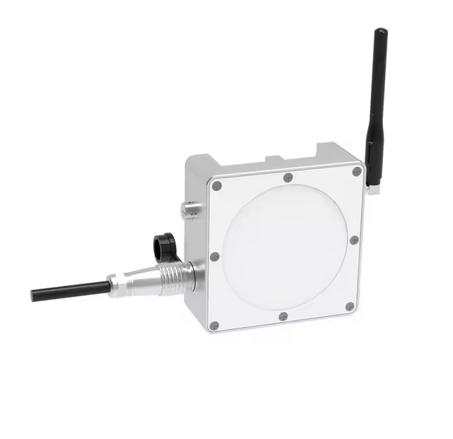
Water velocity sensors provide essential information for understanding river movement and calculating discharge. Their measurement principles and installation requirements vary considerably. For example, a radar velocity meter measures surface flow velocity without direct contact with the water.
Ultrasonic and Acoustic Doppler Sensors
Ultrasonic velocity sensors use sound waves to detect water movement.
Depending on the technology, they may use travel-time differences or Doppler frequency shifts to estimate velocity.
Acoustic Doppler systems measure water movement through signals reflected by suspended particles or other acoustic targets.
Main advantages include:
· No conventional rotating mechanical components.
· Continuous measurement capabilities.
· Potential integration with remote monitoring systems.
· Availability of different installation configurations.
These technologies are useful in applications requiring frequent velocity observations.
However, acoustic performance can be affected by sediment concentration, air bubbles, flow conditions, and installation geometry.
Electromagnetic and Mechanical Sensors
Electromagnetic velocity sensors measure the electrical signal generated when conductive water moves through a magnetic field.
They provide direct velocity measurements without rotating mechanical components.
Their suitability depends on water conductivity, sensor configuration, and installation conditions.
Mechanical current meters use rotating elements to measure water movement. Although their operating principles are straightforward, moving components require more attention during maintenance.
Comparing Water Velocity Sensor Technologies
Sensor Type | Main Strength | Main Limitation | Suitable Application |
Ultrasonic | Non-contact options and flexible installation | Sensitive to some environmental and acoustic conditions | Surface velocity monitoring |
Acoustic Doppler | Detailed velocity measurements | Requires suitable acoustic conditions | River velocity profiling |
Electromagnetic | Direct velocity measurement | Requires water contact and suitable conductivity | Selected submerged installations |
Mechanical | Established measurement method | Moving components require maintenance | Routine field measurements |
How to Select a Sensor for Different River Conditions
Sensor selection should begin with an assessment of the monitoring environment.
For relatively accessible rivers, ultrasonic systems may provide a practical solution where non-contact measurement is preferred.
For projects requiring detailed velocity profiles, ADCP technology may be more appropriate.
Where submerged installation is acceptable, electromagnetic sensors can be evaluated according to water conductivity and mounting conditions.
Mechanical current meters remain useful for field verification and routine hydrological surveys.
The final selection should consider measurement requirements, installation costs, power availability, maintenance access, and compatibility with the monitoring platform.
Data Collection, Analysis and Installation Requirements
Reliable river flow monitoring requires more than accurate sensors. Proper installation, data management, and ongoing verification are equally important.
Monitoring Station Installation and Calibration
The monitoring location should represent the river conditions being studied.
Before installation, engineers should evaluate channel geometry, flow distribution, turbulence, sediment movement, and accessibility.
Sensors must be mounted securely and positioned according to their measurement principles.
For long-term installations, the following checks are important:
· Confirm the measurement location and reference level.
· Verify sensor orientation and mounting stability.
· Check power and communication connections.
· Compare initial readings with suitable reference measurements.
· Document installation parameters and configuration settings.
Calibration should follow manufacturer recommendations and relevant measurement procedures.
After relocation, maintenance, or suspected measurement drift, additional verification may be necessary.
Data Logging and Communication Technologies
Modern river monitoring stations can collect measurements continuously or at scheduled intervals.
Additional rainfall measurements can be collected using a LoRaWAN wireless tipping bucket rain gauge, which transmits precipitation data through a compatible LoRaWAN network.
Data loggers store sensor readings and organize them for subsequent analysis.
Remote communication allows monitoring teams to access information without visiting every station.
Communication Method | Advantages | Limitations |
Cellular | Convenient and widely available in covered areas | Depends on network coverage |
Satellite | Supports isolated monitoring locations | Higher service and equipment costs |
Radio telemetry | Suitable for local monitoring networks | Limited by range and terrain |
Local data logging | Preserves records during communication interruptions | Requires sufficient storage and later data retrieval |
For remote installations, solar-powered equipment and local data storage may improve operational continuity.
Communication security, timestamp accuracy, and data integrity should also be considered during system design.
Interpreting Velocity and Discharge Data
Raw sensor measurements require quality control before they can support operational decisions.
Monitoring teams should identify unusual readings, check possible sensor errors, and compare measurements with historical records.
Velocity observations can then be combined with river cross-sectional information to estimate discharge.
Analyzing these records over time helps identify:
· Seasonal flow variations.
· Rapid increases or decreases in discharge.
· Changes associated with rainfall.
· Potential channel modifications.
· Unusual hydrological conditions.
Consistent data processing improves the usefulness of monitoring results for water management and environmental research.

Applications and Challenges in River Flow Monitoring
Flood Management and Early Warning
River flow monitoring supports flood risk assessment by providing information about changing water movement and discharge.
Rapid increases in flow measurements may indicate developing high-water conditions, particularly when combined with rainfall and upstream observations.
Monitoring stations can transmit measurements to central platforms, where predefined thresholds trigger notifications.
However, reliable flood forecasting requires more than velocity or discharge measurements alone. Rainfall data, river basin characteristics, forecasting models, and upstream monitoring information may also be necessary.
Water Resource and Environmental Management
River flow data supports decisions involving water allocation, irrigation planning, reservoir operations, and ecological management.
Long-term observations help identify changes in seasonal flow patterns and provide information for environmental assessments.
Combining flow measurements with rainfall, water quality, and meteorological observations can provide a more comprehensive understanding of river conditions.
A tipping bucket rain gauge can supply precipitation measurements for this broader analysis.
Common Operational Challenges and Practical Solutions
Operational Challenge | Recommended Approach |
Sediment and debris interference | Select suitable sensor technology and installation positions |
Changing river geometry | Periodically review measurement references and rating curves |
Sensor fouling | Establish inspection and cleaning procedures |
Communication interruptions | Use local data logging and appropriate backup communication |
Power limitations | Evaluate low-power equipment and suitable energy systems |
Measurement inconsistencies | Perform calibration checks and compare reference readings |
Improving Long-Term Monitoring Reliability
A dependable monitoring program requires consistent equipment maintenance and data quality management.
Sensors should be inspected according to their operating environment and manufacturer recommendations.
Monitoring teams should maintain records of calibration, equipment replacement, unusual measurements, and installation changes.
Combining automated observations with periodic field verification helps identify measurement problems before they affect long-term datasets.
Conclusion
Accurate river flow monitoring provides essential information for flood management, water resource planning, and environmental protection. Selecting suitable velocity sensors, applying appropriate discharge measurement methods, and maintaining reliable data collection are all important for successful monitoring projects.
BGT Hydromet provides hydrological and meteorological monitoring solutions for water observation and environmental applications. Its River Flow Monitoring System is relevant to projects requiring river velocity and flow measurement, supporting the development of monitoring configurations based on different site conditions and operational requirements.
FAQ
What is river flow monitoring?
River flow monitoring involves observing water velocity, river discharge, and related hydrological parameters to understand changing river conditions.
What is the difference between river velocity and discharge?
Velocity describes how fast water moves, while discharge describes the volume of water passing a specific location over a given period.
Which sensors are commonly used for river velocity monitoring?
Common options include ultrasonic sensors, acoustic Doppler systems, electromagnetic sensors, and mechanical current meters.
How is river discharge measured?
Common methods include the area-velocity method, stage-discharge relationships, weirs, flumes, and ADCP-based measurements.
Why is continuous river flow monitoring important?
Continuous monitoring helps identify changing flow conditions, supports flood risk assessment, improves water resource planning, and provides long-term hydrological records.