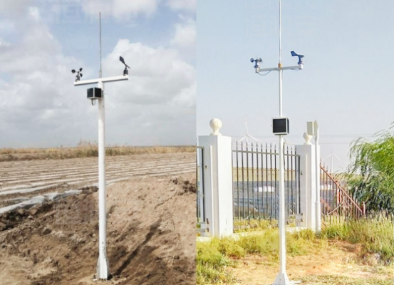
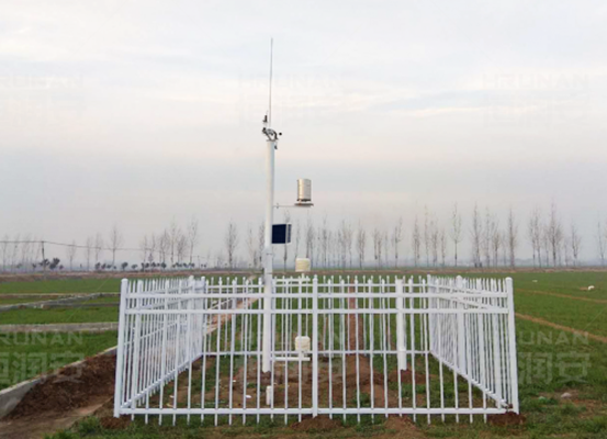
A water level sensor may continue recording measurements during a storm, yet the monitoring center receives nothing. The problem could be a depleted battery, damaged communication equipment, or a data logger that has stopped responding.
At a remote river station, reaching the equipment may take several hours or longer. A small configuration problem can therefore interrupt an important monitoring record.
Building a remote hydrological monitoring station involves more than installing sensors beside a river. The measurement equipment, mounting structures, power supply, communication network, and data management system must operate together under changing environmental conditions.
A successful installation begins with a clear monitoring objective and a configuration suited to the site, rather than a fixed equipment package.
1. Define the Monitoring Requirements Before Equipment Selection
Identify the Hydrological Parameters
The first design decision concerns the information the station needs to collect.
A station used for flood threshold monitoring may require continuous water level observations. A river discharge project may also need water velocity measurements from a radar velocity meter, along with channel information to support discharge estimation.
Some installations include rainfall measurements or cameras to provide additional context.
Monitoring Parameter | Equipment or Measurement Approach | Main Purpose |
River water level | Radar, ultrasonic, or pressure sensor | Tracking changes in river stage |
Water velocity | Acoustic or other suitable velocity sensor | Observing water movement |
River discharge | Velocity and cross-sectional measurements, or a validated rating curve | Estimating water volume passing a section |
Rainfall | Rain gauge | Recording local precipitation |
Site images | Monitoring camera | Visual observation of river conditions |
Station status | Data logger and power monitoring | Detecting equipment or power problems |
Not every station needs all these measurements.
Adding unnecessary sensors increases equipment costs, power consumption, installation complexity, and maintenance requirements.
For a small river level monitoring project, a single suitable sensor may be sufficient. More demanding hydrological studies can require several measurement technologies operating together.
Determine Measurement Frequency and Data Requirements
A monitoring station should collect data at intervals appropriate to its intended use.
For example, a station supporting flood alerts may need more frequent measurements than one collecting long-term background observations.
The configuration should distinguish between the measurement interval and the data transmission interval.
A sensor may collect measurements frequently while the data logger sends accumulated records less often to conserve energy.
Important configuration decisions include measurement frequency, transmission frequency, local storage capacity, timestamp accuracy, and alert conditions.
These settings influence battery consumption and communication costs.
Establish Reliability Requirements
Remote stations may experience equipment faults, communication interruptions, and temporary power shortages.
The system design should therefore identify which failures are acceptable and which require additional protection.
For critical applications, engineers may consider independent sensors, backup power, communication redundancy, or remote fault notifications.
Redundancy should be based on the consequences of failure. A research station collecting historical data may have different continuity requirements from a station supporting time-sensitive flood warnings.
2. Select a Suitable Location for the Hydrological Station
Evaluate River Conditions and Measurement Quality
A convenient installation location is not necessarily a suitable measurement location.
A bridge may offer easy access and a strong mounting structure, but nearby piers can influence local water movement. A riverbank may provide enough space for equipment while exposing the installation to erosion or flood debris.
Site selection should consider the river's behavior across different water conditions.
Important site characteristics include:
· Expected low and high water levels.
· River width, channel geometry, and flow conditions.
· Turbulence, backwater, and sediment accumulation.
· Floating debris during flood events.
· Available mounting structures.
· Access for inspection and maintenance.
· Exposure to flooding and physical damage.
For water level measurement, the installation must provide a stable reference and an unobstructed measurement path where required.
For velocity measurement, the selected position should be appropriate for the sensor's measurement principle and the intended discharge calculation.
Check Access, Security, and Environmental Exposure
Remote hydrological stations are often installed in locations where routine visits are difficult.
The site survey should establish how technicians will reach the station, transport equipment, and perform maintenance safely.
Equipment placed in publicly accessible areas may require locked cabinets, protected cables, and tamper-resistant mounting.
Environmental conditions also influence enclosure selection.
Rainfall, humidity, temperature extremes, lightning exposure, and potential flooding must be considered when choosing equipment protection and installation heights.
The mounting arrangement should remain suitable throughout the expected operating conditions, not only during the initial installation.
Assess Power and Communication Availability
Before confirming the location, engineers should check cellular coverage, possible radio links, satellite communication requirements, and access to electrical power.
Solar exposure is another important factor.
Trees, nearby buildings, steep terrain, and seasonal shading may reduce the energy available to a solar-powered station.
A site with excellent measurement conditions but unreliable power or communication may require additional equipment or a different installation arrangement.

3. Choose the Equipment Configuration for the Monitoring Station
Compact Integrated Monitoring Stations
A compact station combines several basic functions within a relatively small installation.
A typical configuration may include a water level sensor, data logger, communication module, power supply, and mounting assembly.
This arrangement is suitable for projects requiring a limited number of measurements at a single location.
Its advantages include simpler installation and fewer separate components.
However, integrated equipment may offer less flexibility for adding new sensors or changing communication hardware.
Multi-Sensor Hydrological Monitoring Stations
Projects requiring water level, flow, rainfall, or visual monitoring often benefit from a more flexible arrangement.
For combined water level and flow observations, a radar flow meter can provide non-contact measurements that support river discharge estimation.
A multi-sensor station may use a central data logger connected to several measurement devices.
The logger collects readings, manages timestamps, stores records, and communicates with a remote platform.
A camera can provide visual context, particularly when unusual readings need to be checked against site conditions.
The equipment cabinet may contain communication hardware, power management components, protective devices, and terminal connections.
Such a configuration requires careful planning of interfaces, power demand, cable routing, and enclosure space.
Customized Stations for Complex Monitoring Projects
Large watersheds, research programs, and critical infrastructure projects may require customized monitoring arrangements.
These can involve multiple sensors, backup communication, additional power capacity, and integration with existing monitoring networks.
Modular configurations allow components to be selected or replaced independently, provided their interfaces and operating requirements remain compatible.
Configuration | Typical Components | Suitable Application | Main Consideration |
Compact station | Water level sensor, logger, communication, power | Single-point level monitoring | Limited expansion options |
Multi-sensor station | Several sensors, logger, cabinet, telemetry | River monitoring and municipal projects | Integration and power planning |
Customized station | Modular sensors, advanced telemetry, backup systems | Large monitoring networks and specialized projects | Higher engineering complexity |
For procurement teams, the relevant question is not which configuration contains the most equipment. It is which arrangement meets the measurement requirements with manageable installation and operating costs.
4. Configure Sensors, Data Loggers, and Measurement References
Select Sensors According to the Installation Environment
The measurement environment should determine the sensor technology.
Radar water level sensors and ultrasonic water level sensors are installed above the water and measure the distance to the surface.
Pressure transducers operate in contact with water and estimate depth from hydrostatic pressure.
Bubbler systems provide another approach by measuring pressure through an air line.
Each technology has installation and maintenance requirements.
Sensor Technology | Installation Consideration | Potential Maintenance Concern |
Radar water level sensor | Stable above-water mounting and suitable measurement geometry | Mounting alignment and obstructions |
Ultrasonic water level sensor | Clear acoustic path and appropriate environmental conditions | Condensation, temperature effects, and signal interference |
Pressure transducer | Suitable submerged position and pressure compensation | Sediment, fouling, and cable protection |
Bubbler system | Protected air line and pressure measurement equipment | Air supply and tubing maintenance |
Velocity sensor | Position appropriate to flow conditions | Sediment, alignment, and measurement representativeness |
Where a project requires both water level and flow observations, the complete measurement arrangement should be evaluated.
A water velocity sensor alone does not necessarily provide total river discharge without supporting channel information or an appropriate calculation method.
Configure the Data Logger
The data logger connects the measurement equipment to the monitoring system.
Its configuration determines how measurements are collected, stored, processed, and transmitted.
The setup should include the required sensor interfaces, measurement units, sampling schedules, and communication settings.
Common interface types used in environmental monitoring include SDI-12, RS-485, and analog signals such as 4–20 mA. Actual compatibility must be confirmed for each device.
A practical data logger configuration should address:
· Sensor identification and input assignments.
· Measurement units and scaling.
· Measurement and recording intervals.
· Time synchronization.
· Local data storage.
· Communication schedules.
· Alarm conditions and equipment status reporting.
If the station uses different sensor brands or models, engineers should verify that the logger can interpret their outputs correctly.
Establish the Water Level Reference
A water level reading is meaningful only when its reference is clearly defined.
For a non-contact sensor, the measured distance from the instrument to the water surface must be related to the selected reference level.
For a submerged pressure sensor, installation depth and relevant compensation requirements must be considered.
The station documentation should record sensor position, mounting elevation, reference datum, and configuration settings.
Without a consistent reference, measurements collected before and after maintenance may be difficult to compare.
This becomes especially important when the station contributes to long-term hydrological records.
5. Design the Power Supply and Remote Communication System
Calculate the Station's Power Requirements
Power supply design should begin with the actual electrical demand of the installed equipment.
Sensors, data loggers, communication modules, and cameras may have different consumption patterns.
Some devices operate continuously, while others draw additional power during measurement or transmission.
A power assessment should consider:
Component | Power Planning Consideration |
Water level sensor | Operating and standby consumption |
Velocity sensor | Measurement duty cycle and operating demand |
Data logger | Continuous operation and low-power modes |
Cellular or satellite modem | Transmission-related power peaks |
Camera | Imaging frequency and operating demand |
Battery | Required autonomy and temperature conditions |
Solar panel | Seasonal energy production and shading |
Solar panel and battery capacity should be calculated from the equipment's expected energy consumption, local sunlight conditions, charging losses, and required operating autonomy.
Simply selecting a larger battery does not resolve an undersized solar charging system.
Choose Between Solar, Battery, and Grid Power
For isolated locations without electrical infrastructure, solar panels and rechargeable batteries are commonly considered.
For example, a solar-powered smart IoT radar level sensor can provide non-contact water level monitoring with integrated power and remote communication capabilities.
The battery supports operation during nighttime and periods of limited sunlight.
Where grid power is available, it may simplify the installation, although local outages and electrical protection still need to be evaluated.
Backup batteries can support operation during temporary interruptions.
The selected power arrangement should match the monitoring site's operating conditions and maintenance accessibility.
Select the Communication Method
Remote hydrological stations commonly use cellular, satellite, or radio communication.
Cellular networks can be practical where signal coverage is sufficient.
Satellite communication may be appropriate for isolated locations without terrestrial coverage, although equipment, service costs, and power consumption require consideration.
Radio telemetry can support local networks where terrain and communication range permit.
Communication Method | Suitable Conditions | Main Planning Concern |
Cellular | Locations with reliable mobile coverage | Signal strength and network availability |
Satellite | Remote areas without terrestrial networks | Cost, antenna placement, and power |
Radio | Regional monitoring networks | Terrain, range, and supporting infrastructure |
Communication testing should be performed at the intended installation location rather than relying solely on general coverage maps.
Prepare for Communication Interruptions
A monitoring station should be able to retain measurements when the network is temporarily unavailable, if continuity of the historical record is required.
Local data logging allows readings to be stored and transmitted after the connection is restored, provided the equipment supports this function.
The system should also distinguish between a sensor failure and a communication failure.
For example, the sensor may continue collecting valid measurements even when the remote platform cannot receive them.
Backup communication may be justified for critical applications, but it should not be treated as a universal requirement.
Stored measurements also cannot deliver immediate remote warnings while all communication paths remain unavailable.
6. Install, Commission, and Maintain the Monitoring Station
Prepare the Installation and Mounting Arrangement
Once the equipment configuration is approved, the installation team can prepare the mounting structures, cabinet, power system, and cable routes.
Sensors should be positioned according to their measurement requirements.
Non-contact water level sensors need a suitable view of the water surface. Submerged sensors require secure mounting and protection appropriate to their environment.
Electrical cabinets should be placed with consideration for flooding, access, and environmental exposure.
Cable routing should avoid unnecessary mechanical stress and protect connections from moisture and physical damage.
Grounding and surge protection should be designed according to the installation conditions and applicable electrical requirements.
Perform Commissioning Tests Before Handover
Commissioning verifies that the installed equipment operates as intended.
A sensor displaying a reading is not sufficient evidence that the complete station is functioning correctly.
The installation team should test the measurement, storage, power, and communication functions together.
Commissioning Check | Verification Objective |
Sensor readings | Confirm measurements against suitable reference observations |
Measurement datum | Verify reference elevation and configuration |
Data logger inputs | Confirm correct sensor channels, units, and scaling |
Data timestamps | Check clock settings and synchronization |
Local storage | Confirm measurements are recorded correctly |
Communication | Verify transmission to the receiving platform |
Power system | Check charging, battery status, and operating voltage |
Alarm configuration | Test the required notification conditions |
Communication recovery | Confirm expected behavior after a temporary outage |
Any configured alarm thresholds should reflect the project's established operating procedures.
A threshold-based notification system should not be presented as a complete flood forecasting capability.
Document the Final Station Configuration
A station may operate for years and be maintained by several different technicians.
Clear documentation helps preserve measurement consistency and simplify repairs.
The handover records should include the equipment inventory, sensor locations, reference elevations, wiring information, configuration settings, and communication details.
Calibration records, maintenance instructions, and relevant access procedures should also be retained.
Where equipment is replaced, the change should be documented so that later data analysis can account for possible differences between instruments.
Establish a Maintenance Schedule
Remote monitoring reduces the need for frequent manual readings, but it does not eliminate field maintenance.
Inspection frequency depends on the environment, equipment type, and importance of the monitoring data.
After severe weather, additional checks may be necessary to identify damaged structures, displaced sensors, or debris accumulation.
Common maintenance activities include cleaning sensors, inspecting mounting hardware, checking batteries, verifying communication, and comparing measurements with reference observations.
Remote diagnostics can help identify unusual conditions before a technician travels to the site.

7. Example Configurations for Different Monitoring Projects
A single equipment arrangement cannot meet every hydrological monitoring requirement.
The following configurations illustrate how system design changes with project scope. They are general engineering examples rather than specifications for particular products.
Project Type | Example Equipment Configuration | Main Design Priority |
Remote river level station | Radar level sensor, data logger, solar power, cellular or satellite telemetry | Reliable unattended water level measurement |
River hydrological station | Water level sensor, suitable velocity measurement equipment, logger, communication system | Coordinated level and flow observations |
Flood observation station | Water level sensor, optional rain gauge and camera, logger, communication, alert configuration | Timely measurements and dependable notifications |
Research monitoring station | Multiple sensors, modular logger, local storage, power and communication arrangements | Data quality, flexibility, and long-term consistency |
Remote River Level Station
A station measuring water level at a single river location may use a non-contact sensor mounted on a suitable structure.
The sensor sends measurements to a data logger, which stores and transmits records according to the configured schedule.
Solar power may support operation where grid electricity is unavailable.
The design should emphasize a stable measurement reference, suitable sensor positioning, and dependable data retrieval.
Multi-Parameter Hydrological Station
A broader monitoring project may require water level, velocity, and rainfall observations.
A high-precision tipping bucket rain gauge can collect precipitation measurements to complement river level and velocity data.
In this arrangement, a central data logger can collect measurements from different instruments and transmit them to a monitoring platform.
The configuration must account for different measurement intervals, interfaces, and power demands.
For projects of this type, the river hydrological monitoring systems offered by BGT Hydromet provide a relevant equipment category to evaluate against the required monitoring parameters and installation conditions.
The final system configuration should be confirmed against actual device specifications and project requirements.
Flood Observation Station With Visual Monitoring
A camera can add useful visual information to a monitoring station.
Images may help operators assess visible river conditions, check for debris, or investigate unusual sensor readings.
However, cameras introduce additional considerations involving power consumption, data transmission, image storage, and environmental protection.
They should be included where visual observations provide a defined operational benefit.
Conclusion
A remote hydrological station should be designed around the conditions it will encounter when no technician is present.
The sensor must remain properly positioned as water levels change. The power system must support operation through expected periods of limited charging. Measurements must be stored correctly, even when communication is interrupted. Each of these requirements influences the equipment configuration.
For hydrological projects involving different measurement parameters and deployment environments, BGT Hydromet works in the field of hydrological and meteorological monitoring equipment. Evaluating the available measurement solutions alongside site conditions, power requirements, and data integration needs provides a practical basis for specifying a station that can be operated and maintained over time.
FAQ
What equipment is needed for a remote hydrological monitoring station?
A typical station includes suitable sensors, a data logger, a power supply, communication equipment, mounting structures, and a receiving platform.
Can a hydrological station operate without grid electricity?
Yes. Solar panels and batteries can support remote operation when correctly sized for equipment demand and local conditions.
How are measurements transmitted from remote stations?
Common methods include cellular, satellite, and radio communication, depending on coverage, terrain, power requirements, and project needs.
What happens when the communication network fails?
A data logger may store measurements locally and transmit them after connectivity returns, if the system supports this function.
How often should a remote hydrological station be maintained?
Maintenance frequency depends on the equipment, environment, and monitoring requirements. Additional inspections may be needed after severe weather.