River water level monitoring is essential for flood risk management, hydrological observation, and water resource planning. However, collecting reliable water level data from remote rivers presents challenges involving power supply, communication coverage, environmental conditions, and equipment maintenance.
A suitable monitoring system must measure water levels accurately while maintaining dependable operation at locations with limited infrastructure.
This guide explains the main types of river level sensors, important selection criteria, remote power and communication options, and installation practices for long-term monitoring projects.
Types of River Level Sensors for Remote Monitoring
Different river environments require different measurement technologies. The most suitable sensor depends on water conditions, measurement range, installation requirements, and maintenance accessibility.
Ultrasonic Water Level Sensors
Ultrasonic water level sensors measure the distance between the sensor and water surface using reflected sound waves. They are normally installed above the water, allowing non-contact measurement.
Key advantages:
· No direct contact with river water.
· Reduced exposure to sediment and floating debris.
· Suitable for bridges and elevated mounting structures.
· Convenient access for inspection and maintenance.
However, temperature variations, condensation, surface turbulence, and obstructions can affect measurement performance.
Ultrasonic sensors are suitable for remote locations where stable mounting and appropriate environmental conditions are available.
Radar Water Level Sensors
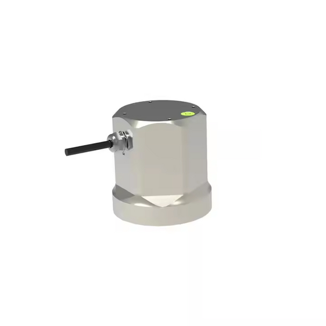
Radar water level sensors transmit electromagnetic signals toward the water surface and determine the distance from the returned signal.
Like ultrasonic devices, they provide non-contact measurement without requiring the sensing element to remain submerged.
Radar technology is often considered for demanding outdoor environments because its measurement principle is less sensitive to air temperature variations.
It can be useful for rivers experiencing changing water levels, high humidity, or difficult maintenance conditions.
However, performance still depends on sensor specifications, installation geometry, water surface conditions, and potential signal interference.
Pressure and Float-Based Sensors
Submersible water pressure level sensors determine water depth by measuring hydrostatic pressure at a submerged location.
They can provide continuous measurements but require appropriate installation and maintenance.
Sediment accumulation, fouling, changes in water density, and atmospheric pressure compensation may influence measurement accuracy.
Float-based sensors use a buoyant element to follow water level changes. They are generally associated with relatively simple measurement arrangements, although mechanical components require inspection.
Comparison of River Level Sensor Technologies
Sensor type | Measurement method | Main advantage | Main limitation | Suitable application |
Ultrasonic | Non-contact sound waves | Avoids direct water exposure | Sensitive to some atmospheric and surface conditions | Bridges and accessible riverbanks |
Radar | Non-contact electromagnetic signals | Suitable for demanding outdoor conditions | Requires appropriate mounting and signal clearance | Remote rivers and flood monitoring stations |
Pressure transducer | Submerged pressure measurement | Continuous water depth measurement | Exposure to sediment and fouling | Protected submerged installations |
Float-based | Mechanical water level tracking | Relatively simple operating principle | Mechanical wear and obstruction risks | Sheltered measurement stations |
No sensor technology is suitable for every monitoring location.
For remote rivers with sediment, debris, and limited maintenance access, non-contact radar or ultrasonic sensors may offer practical advantages.
Key Factors When Selecting a River Water Level Monitoring System
A reliable system requires more than a suitable sensor. Measurement performance, environmental protection, power availability, and maintenance requirements must be evaluated together.
Measurement Accuracy and Operating Range
Before selecting a sensor, project engineers should define the expected minimum and maximum water levels.
The measurement range must accommodate normal seasonal changes and anticipated flood conditions.
Important technical parameters include:
· Measurement range: The distance or water depth the sensor can measure.
· Accuracy: The expected difference between measured and reference values.
· Resolution: The smallest detectable measurement change.
· Sampling interval: How frequently readings are collected.
· Environmental tolerance: The operating temperature and exposure conditions.
· Calibration requirements: The procedures used to verify measurement performance.
The measurement reference level is equally important. Water level readings should be associated with a defined local datum or elevation reference to support consistent analysis.
For flood monitoring projects, engineers should also consider how measurement uncertainty affects alert thresholds.
Environmental Conditions and Equipment Protection
Remote monitoring equipment may be exposed to heavy rainfall, high humidity, flooding, temperature changes, and debris.
Sensors and associated equipment should therefore be selected according to actual site conditions.
Site condition | Recommended consideration |
Heavy rainfall and humidity | Suitable enclosure protection and sealing |
Floating debris | Protected mounting position or non-contact measurement |
Sediment accumulation | Sensor placement and cleaning requirements |
Extreme temperatures | Verified operating temperature range |
Lightning exposure | Appropriate grounding and surge protection |
Difficult maintenance access | Remote diagnostics and durable components |
The enclosure protection rating should match the installation environment. Submerged components require protection appropriate for immersion, while above-water equipment must withstand expected outdoor exposure.
Installation and Maintenance Requirements
Accessibility is particularly important at remote river monitoring stations.
A system requiring frequent cleaning or recalibration may create significant operating costs when technicians must travel long distances.
Modular components, accessible mounting brackets, remote status monitoring, and clear maintenance instructions can simplify long-term operation.
Project planners should consider both initial equipment costs and expected maintenance requirements.

Power Supply and Data Transmission for Remote Monitoring
Remote river stations often operate without a reliable electrical grid or fixed communication infrastructure.
Power and communication systems must therefore be designed around local conditions and monitoring requirements.
Solar Power and Battery Systems
Solar panels combined with rechargeable batteries are commonly used for unattended monitoring stations.
For example, a solar-powered radar level sensor can integrate non-contact water level measurement, solar charging, battery storage, and wireless data transmission for remote river monitoring.
During daylight hours, the solar panel generates electricity. A charge controller manages battery charging, while stored energy supports operation when sunlight is unavailable.
The system should be sized according to:
· Sensor and data logger power consumption.
· Communication equipment energy requirements.
· Measurement and transmission frequency.
· Local solar radiation and seasonal conditions.
· Required operating autonomy during low sunlight.
· Battery temperature and charging limitations.
A larger solar panel does not automatically guarantee reliable operation.
Battery capacity, controller efficiency, installation orientation, and actual energy consumption must also be considered.
Cellular, Satellite, and Radio Communication
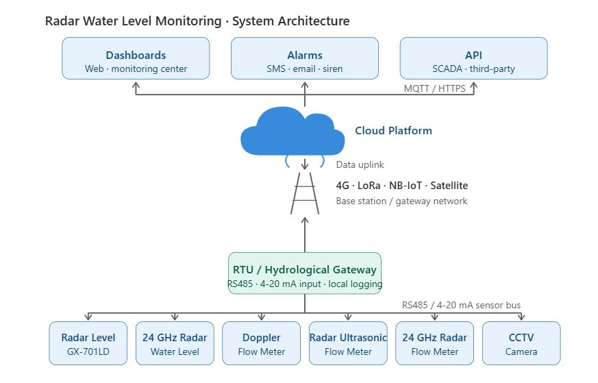
Remote water level monitoring requires a communication method capable of transmitting measurements to the receiving platform.
Communication method | Main advantage | Main limitation | Suitable conditions |
Cellular networks | Practical data transmission where coverage exists | Depends on network availability | Rivers with mobile coverage |
Satellite | Communication in areas without terrestrial networks | Higher equipment and service costs | Isolated watersheds |
Radio telemetry | Suitable for local sensor networks | Range and terrain constraints | Multiple stations within a regional network |
Communication selection should reflect network coverage, terrain, transmission frequency, power consumption, and operating budget.
For critical monitoring projects, alternative communication paths may improve resilience when the primary network becomes unavailable.
Data Logging During Communication Outages
A remote monitoring station should not depend entirely on continuous network connectivity.
A data logger can store timestamped measurements locally and transmit stored records when communication is restored, provided sufficient storage and recovery functions are available.
Important features include local memory capacity, accurate timestamps, data integrity checks, and configurable transmission intervals.
This arrangement reduces the risk of losing measurement records during temporary network outages.
However, stored data cannot provide immediate remote alerts until communication is restored.
Installation and Maintenance of Remote River Level Sensors
Correct installation is essential for dependable measurements. Even a suitable sensor can produce unreliable data if it is mounted in an inappropriate location.
Selecting a Suitable Monitoring Location
A site survey should evaluate river geometry, water flow, seasonal flooding, sediment movement, and access conditions.
For non-contact sensors, the measurement path must remain clear of structural obstructions.
The sensor should be installed at a height that accommodates expected high water levels without exceeding its measurement range.
For submerged sensors, the mounting location should minimize exposure to excessive sediment accumulation and physical damage.
Site assessment should cover:
· Expected minimum and maximum water levels.
· River turbulence and surface conditions.
· Sediment and floating debris.
· Mounting structure stability.
· Flood exposure of electrical equipment.
· Solar panel positioning and shading.
· Communication signal availability.
· Safe access for future maintenance.
A well-chosen installation position improves both measurement reliability and maintenance efficiency.
Calibration and Commissioning
Before commissioning, the sensor should be configured according to the manufacturer's instructions.
The installation team should establish the measurement reference, verify mounting geometry, and compare readings against a suitable reference measurement.
Communication, power supply, local data storage, and alarm functions should also be tested.
Commissioning task | Purpose |
Verify sensor position | Confirm the measurement path and reference |
Check measurement readings | Identify possible installation errors |
Test data transmission | Confirm communication with the monitoring platform |
Check battery and solar system | Verify power operation |
Test local data logging | Confirm storage during communication interruptions |
Verify alert settings | Check the configured notification process |
The completed installation should be documented, including sensor location, mounting height, configuration settings, and reference elevation.
Routine Inspection and Troubleshooting
Maintenance intervals depend on sensor technology, site conditions, and manufacturer recommendations.
Routine checks may include inspecting mounting brackets, cleaning exposed sensor surfaces, verifying readings, and checking power and communication status.
Common operational problems include:
· Missing measurements: Possible power, sensor, or data logger issues.
· Communication interruptions: Network coverage or communication equipment problems.
· Unexpected level changes: Sensor obstruction, turbulence, or reference errors.
· Low battery voltage: Insufficient charging or increased power consumption.
· Inconsistent readings: Installation movement or calibration problems.
Remote diagnostics can help identify problems before a technician visits the monitoring station.

Using River Water Level Data for Flood Monitoring and Water Management
A monitoring system becomes more valuable when collected measurements are converted into useful operational information.
Data platforms, historical records, and alert functions help operators identify changing river conditions.
Real-Time Monitoring and Historical Analysis
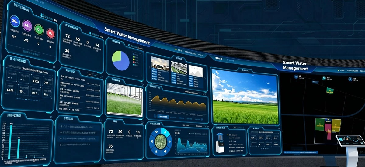
A monitoring platform can display current water levels alongside historical measurements.
Charts and dashboards help users observe seasonal changes, rising water levels, and unusual fluctuations.
For organizations managing multiple stations, centralized monitoring supports consistent data review across different river locations.
Historical records can also contribute to hydrological studies, infrastructure planning, and water resource assessments.
Flood Alert Thresholds and Notifications
Water level thresholds can be configured to trigger alerts when measured values reach predefined conditions.
Depending on the system, notifications may be delivered through SMS, email, or a connected monitoring platform.
Alert configuration should consider:
· Local river characteristics.
· Established warning levels.
· Measurement uncertainty.
· Data transmission delays.
· Communication reliability.
· Responsible personnel and response procedures.
A water level threshold alert is not the same as a flood forecast. Forecasting generally requires additional hydrological information, models, and analysis.
Automated alerts provide timely measurement information, but operational decisions should follow the relevant flood response procedures.
Integration With Other Hydrological Measurements
River level data can be combined with rainfall, weather, and other hydrological measurements.
For example, rainfall data collected by a tipping bucket rain gauge may help explain rapid changes in river levels, while measurements from multiple stations can support broader watershed analysis.
Compatible communication protocols, data formats, and platform interfaces can simplify future expansion.
Conclusion
Selecting a river water level monitoring system for remote locations requires a coordinated approach to sensor technology, power supply, data communication, installation, and maintenance.
Radar and ultrasonic sensors can reduce direct exposure to water, while pressure-based sensors remain useful for suitable submerged installations. Reliable power, local data logging, and appropriate communication are equally important for unattended monitoring stations.
BGT Hydromet focuses on hydrological and meteorological monitoring solutions for water resource observation and related applications. Its River Water Level Monitoring System solutions provide a relevant starting point for evaluating measurement technologies and system configurations according to project requirements.
FAQ
What is the best river level sensor for remote monitoring?
The best option depends on site conditions. Radar and ultrasonic sensors are useful for non-contact measurement, while pressure sensors suit appropriate submerged installations.
Can river water levels be monitored without grid electricity?
Yes. Solar panels and rechargeable batteries can support remote stations when properly sized for equipment demand and local conditions.
How is water level data transmitted from remote rivers?
Common methods include cellular, satellite, and radio communication. The choice depends on network coverage, terrain, power requirements, and budget.
What happens when the monitoring station loses communication?
A data logger may store measurements locally and transmit them after communication is restored, depending on system capabilities.
Can a river level monitoring system provide flood warnings?
Yes. A suitably configured system can generate threshold-based alerts. Reliable flood forecasting requires additional data and analysis.