Views: 0 Author: Site Editor Publish Time: 2025-10-09 Origin: Site
Landslides put many people in danger and can harm buildings everywhere. You can help keep your community safe with geological disaster monitoring. Early warning with tools like BGT Hydromet, Stress-Strain Sensor, and Deformation And Displacement Sensor lets you find problems before they happen. Finding risks fast can save lives and keep things safe. New technology helps you feel ready and act fast when nature is hard to predict.
Geological disaster monitoring uses tools like Stress-Strain Sensors to find ground movement. This helps people spot landslide risks early.
Real-time monitoring gives fast updates about slope safety. Quick alerts can save lives and keep property safe.
Seeing signs of possible landslides, like cracks or strange water flow, is very important for community safety.
Using early warning systems can lower landslide damage a lot. Fast alerts help people leave quickly.
Teaching the community about landslide risks and monitoring tools helps people act and stay safe.
Geological disaster monitoring lets people watch changes on the earth’s surface. Special tools help track movement, rainfall, and soil moisture. Some tools are the Stress-Strain Sensor and the Deformation And Displacement Sensor. These tools show how much the ground moves or stretches. When you gather this data, you can look for patterns. This helps you know if a landslide could happen.
Tip: Sensors can check for cracks or ground shifts. This helps you find problems early.
Here is a table with some common ways to monitor:
Monitoring Technique | Description |
|---|---|
Rock and Soil Displacement Monitoring | Measures how much rocks and soil move or slide. |
Groundwater Level Monitoring | Checks water levels underground to see if the ground is stable. |
Rainfall Monitoring | Tracks rain to find out if heavy storms might cause landslides. |
Soil Moisture Content Monitoring | Measures how wet the soil is, which can affect landslide risk. |
Ground Stress Monitoring | Looks at pressure inside the ground to see if it might shift. |
You use these ways to collect information and make graphs. You can study the lines and guess if a landslide will happen soon.
Geological monitoring helps keep you and your community safe. Watching for changes in the ground gives early warnings about landslides. This helps you get ready and stay out of danger. You also help protect homes, schools, and roads.
You can guess natural hazards and prepare before they happen.
You help lower risks and keep people safe.
You support flood control and help buildings stay strong.
International rules, like the Sendai Framework and ISO 22315:2014, say early warning systems are important. These systems help you send alerts fast and keep everyone safe. When you use geological monitoring, you help your community stay strong and ready for anything.
You can find signs that a landslide might happen soon. Landslide monitoring helps you see changes in the ground and buildings. When you check ground displacement, you look for hints that the slope is not safe. Here are some signs you should notice:
New cracks or bumps in the ground, roads, or driveways.
Water running down a slope or pooling where it never did before.
Utility poles leaning, wires drooping, or trees tilting on hills.
Doors or windows that stick, and new cracks in walls or ceilings.
Water, septic, or sewer lines that break or leak.
Soil moving away from the base of buildings.
Strange changes in water well levels.
Odd sounds like cracking, rumbling, or snapping trees.
Stream water levels changing fast after heavy rain.
Pavement that falls apart, rocks that fall, or trees leaning near a hill.
You use a monitoring program to check these signs often. Stress-Strain Sensor and Deformation And Displacement Sensor help you measure how much things move. These sensors give you real-time data about slope and ground movement. When you see these signs, you know the area could have a landslide.
You also need to watch the weather. Heavy rain and wet soil can make slopes unsafe. Climate change brings more extreme weather, which raises landslide risk.
More extreme weather and different rain patterns from global warming make landslides more likely. Heavy rain from climate change can soak the soil and make slopes weak, so landslides happen more. Melting glaciers and permafrost also make slopes less stable in mountains and cold places.
You can guess when landslides might happen by using data from many sources. Landslide monitoring uses geotechnical instrumentation, remote monitoring, and real-time monitoring to collect information about ground movement, rain, and soil moisture. You use this data to see how the slope acts and when it might fail.
Here is a table showing how key things affect landslide risk:
Parameter | Description |
|---|---|
Soil Moisture | Very important for landslide risk; high moisture means more chance of a landslide. |
Rainfall | More rain means wetter soil and more landslides. |
Ground Movement | Changes in the ground can make slopes less safe. |
You also check how much water is in the soil and how much the soil changes shape. When it rains a lot, water fills the soil and raises pore water pressure. This makes the slope weaker and landslides more likely.
Condition | Result |
|---|---|
Increased Moisture | More pore water pressure, so landslides are more likely. |
Saturation | When soil is full of water, it is close to failing. |
You use analysis models to guess when landslides might happen. These models use your monitoring data to predict where and when landslides could occur. Here are some common models:
Model Name | Description |
|---|---|
APSO-SVR-LSTM | Uses LSTM to look at time data and SVR to predict well with small samples. |
VMD–SSO–LSTM | Good for watching and warning about landslide dangers. |
Random Forest (RF) | Works well with hard, non-linear problems for mapping landslide risk. |
Support Vector Machines (SVM) | Does a good job mapping where landslides might happen. |
These models help you guess where landslides could happen in risky areas. You use the system to send warnings and act before something bad happens. The accuracy of these prediction tools is high. Some models are right up to 95.6% of the time, while others are right 80% to 94% of the time.
Model | Accuracy Rate |
|---|---|
Model 1 | 95.6% |
Model 2 | 80-94% |
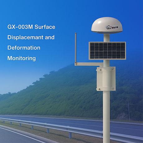
You need to watch ground displacement and slope movement with geotechnical instrumentation. Stress-Strain Sensor and Deformation And Displacement Sensor give you important data for your study. When you use a monitoring program and advanced sensors, you help keep your community safe from landslides and ground problems.
Climate change makes weather more extreme, so there is more heavy rain and runoff. Long rain can make the soil full of water, which raises landslide risk. Cutting down trees for farming or logging removes plants that hold soil in place, so slopes can fail more easily.
 |  |
There are many advanced tools to help watch for landslides. BGT has many tools that track ground movement and slope changes. The GX-SAR2000 Fixed Slope Stability Monitoring Radar checks how stable a slope is. The BGT-FBG4000T Wide-range FBG Strain Transducer shows how machines and ground surfaces change shape. Stress-Strain Sensors and Deformation And Displacement Sensors measure how much the ground moves or stretches. These sensors help you find danger early.
Here is a table with equipment used for geological monitoring:
Equipment Type | Function/Description |
|---|---|
Vibrating Wire Piezometers | Measures pore water pressure accurately. |
In-Place Inclinometers | Estimates lateral movement and deformation. |
Extensometers | Monitors changes in length or displacement. |
Crack Meters | Monitors displacement/opening of cracks in structures. |
Creep Meters | Monitors displacement/opening of faults in the ground. |
Center Hole Load Cells | Monitors tension in anchors. |
Rain Gauges | Monitors rainfall levels. |
Automatic Total Stations | Used for geodetic monitoring with telemetry capabilities. |
SDI-12 Digital Interface | Connects geotechnical sensors to data loggers for automatic monitoring. |
GSM/GPRS Telemetry | Enables remote data transmission for monitoring systems. |
Stress-Strain Sensors and Deformation And Displacement Sensors help you check ground movement. These tools give you good information about slope safety.
Real-time monitoring lets you see changes right away. You get instant data about ground movement. This helps you make fast choices. Sensors, radar, and other tools work together to show slope conditions. The GX-SAR1000 ground-based synthetic aperture radar checks slope changes in real time. When you use these systems, you can send alerts if the ground moves too much. This keeps people safe and helps you act fast.
Real-time data helps you know when slopes are unsafe.
You can guess when landslides might happen and warn others.
Monitoring helps you check risks and report dangers quickly.
After a landslide, you can watch ground movement to stop more problems.
Engineers use remote sensing and models to guess slope failures. Machine-learning algorithms, like Long Short-Term Memory networks, help predict slope failure by looking at deformation data. Real-time forecasts use data techniques to make warning systems better.
Tip: Real-time monitoring helps you act fast in emergencies. You can keep your community safe by moving quickly when you see warning signs.
You can use geological monitoring data to send out warnings. These alerts help protect people in your community. When sensors like the Stress-Strain Sensor or Deformation And Displacement Sensor find ground movement, you get updates right away. These alerts let you act fast and keep everyone safe.
Warnings sent on time can stop over 90% of landslide damage. If you know where and when landslides might happen, you can stay safe and save lives.
Local governments and groups have rules to make sure everyone gets alerts. For example, El Salvador’s Ministry of Natural Resources keeps a record of landslides. They use site visits and online pictures to check their data. New projects make better ways to collect and store this information. This helps keep communities safer.
BGT’s technology helps people get ready for disasters. Their sensors work with solar power, so they keep sending updates even in bad weather. AI models look at the sensor data and send alerts. This helps you make quick choices.
You can use monitoring data to help stop landslides before they start. Landowners and forestry workers use checks to avoid risky slopes. They look at the land and do surveys to find places where landslides could happen. Special plans help study each area and check for landslide risk.
Adaptive management helps stop too much dirt from getting into streams. It also keeps logging from causing more landslides.
City planners use geological data to make cities safer. Systems like the Urban Information System use maps and other data to help plan new roads and buildings. The U.S. Geological Survey gives facts about natural hazards. This helps cities get ready and protect people.
Stress-Strain Sensor and Deformation And Displacement Sensor give you key data for these actions. You can use this information to make buildings stronger, plan safer roads, and help your community stay strong.
Landslide monitoring helps keep people safe. Early warning systems tell you about danger before a landslide happens. You get time to move to a safer place. Sensors like the Stress-Strain Sensor and Deformation And Displacement Sensor watch for ground movement. They send alerts if something changes. These alerts can save lives.
You get updates about slope safety right away.
You can warn your family and neighbors fast.
You help emergency teams act quickly.
Many places use monitoring to protect people. In Myanmar, a group used an early warning system called Community Slope SAFE. This helped people stay safe after cyclone Komen in 2015. Local groups learned to use simple sensors. They shared alerts with everyone. This made the whole community more ready for landslides.
If you know about landslide risks early, you can stay safe and help others too.
Teaching the community is important. Programs about seismology and earth science help people learn why monitoring matters. These programs teach you how to read data and what to do.
Program Goals | Impact on Geological Monitoring |
|---|---|
Help more people understand | More people join monitoring work |
Train skilled workers | Skilled people collect and study data |
Make learning resources | Makes information easy for everyone |
Landslide monitoring also protects homes, roads, and schools. Sensors and early warning systems help stop damage before it starts. Hazard monitoring gives you information to plan repairs or move things out of danger.
Early warnings help save buildings and roads.
You can choose safe places for new homes and schools.
Monitoring helps you avoid expensive repairs.
Here are ways monitoring protects property:
Evidence Type | Description |
|---|---|
Seismic Monitoring | Finds ground shaking that can mean landslides. |
Early Warning | Sends alerts for landslides, rockfalls, and debris flows fast. |
Predictive Variable | Uses sensor energy data to guess big landslides. |
In Southwest China, early warning systems helped people leave before landslides happened. Real-time monitoring in other places, like loess hills, stopped disasters by giving alerts in time. These systems use tools like the Stress-Strain Sensor to track changes and send warnings.
Monitoring also saves money. Cost-effective systems help you avoid big losses from landslides. Planting on hillsides and careful planning give extra protection. When you use monitoring, you make your community stronger and safer.
Good monitoring keeps people and property safe. It helps you feel calm every day.
Geological monitoring helps keep you safe from landslides. You use tools like the Stress-Strain Sensor and Deformation And Displacement Sensor to watch for ground changes. These tools give you early warnings. Modern systems use old records, GIS, and real-time alerts to protect your community.
Automated monitoring and smart networks help you a lot.
You get alerts quickly and can respond faster in emergencies.
Your community knows about dangers and can get ready.
Key Parameters | Description |
|---|---|
Real-time tracking | You notice cracks and ground movement right away |
Systematic monitoring | You check both above and below the ground |
Early warning systems | You get alerts before landslides can hurt anyone |
BGT’s advanced solutions help you protect people, homes, and your future.


